

Aerial surveying and mapping with drone photogrammetry produce survey-grade 3D maps and models. Drones increase productivity by boosting efficiency and reducing operational costs since operators have to spend less time on the field. It provides accurate results and easily repeatable data. The maps and models can be updated as and when needed, at low costs.
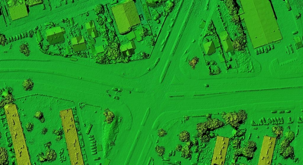
DIGITAL SURFACE MODEL (DSM)
Drones can be used to generate geomorphological data. They can capture multi-temporal photos, and geomorphological features can be mapped and analyzed using photogrammetry methods. Drones are a promising tool for creating digital surface models. They make the analysis and mapping of terrains, land management, and landscape development simpler and efficient.
2D / 3D MAPPING
Accurate and detailed data provided by drones through high-resolution photos allows measuring and mapping various areas, including hard-to-reach places. The aerial imaging data is processed by software to create accurate and usable maps. The higher the altitude covered by the drone, the larger is the area covered. On the other hand, the lower the drone flies, the more detailed the image is. 2D orthophotography is used to measure geographical distances on the surface of the Earth. Using the collected images, the software combines the information with oblique side images taken and create 3D models. The 2D and 3D maps allow viewing from any side or orientation and allow calculation of volume, length, area, cut/fill, and elevation.
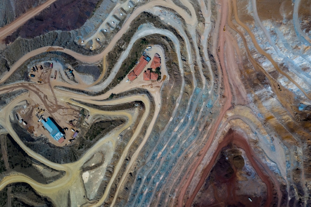
ORTHOMOSAIC
Orthomosaic maps are detailed and accurate, created by putting together many photos that have been geometrically corrected (orthorectified). These maps offer survey-grade measurements of buildings, topography, and infrastructure. UAV photography captures high-resolution images with minimal distortion. This makes acquiring accurate data easier, more accessible, safer, and cost-effective.